News
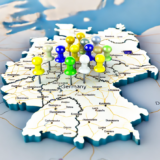
We have expanded address points throughout Germany
23. 7. 2024
We have significantly expanded our address points database across Germany. We have added over 10 million new addresses.
New feature for static maps
28. 5. 2024
We are adding a REST API for static maps. You can use this feature if you need to get an image of a selected area’s map.
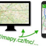
Mapy.cz documented URL
18. 3. 2024
We have prepared new documented Mapy.cz URLs. With them, you can easily construct URLs that Mapy.cz understands (both web and mobile applications).
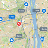
New function for Matrix routing
15. 3. 2024
We are adding a REST API for matrix routing. With this function, you can find the time and distance between M starts and N destinations with one query.
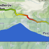
Function for working with elevation
8. 2. 2024
We have just added a new feature for working with altitude to the Mapy.cz REST API.
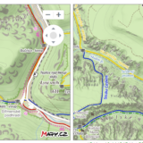
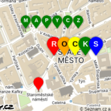
New appearance of the rocks in tourist map
12. 1. 2024
We have changed the visualization of rocks on the tourist map, currently only in the Czech Republic. In addition to rocks, we also have more detailed contour lines and shading on the map. The depiction of rocks now more accurately corresponds to reality and precisely fits the relief and contour lines. Take a look at…
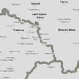
New map set names-overlay
14. 11. 2023
We are adding a new map set called names-overlay. It consists of transparent tiles that contain only names (of countries, cities, streets, etc.) and country borders.
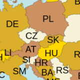
ISO country code in geocoding
21. 9. 2023
We are adding the ISO country code, according to the ISO 3166-1 alpha-2 standard, to the return values of functions for Geocoding (Geocode, Suggest, RGeocode).

REST API – full version
12. 7. 2023
The REST API is finally leaving beta and coming in its full version, now available to all users. The main change is the introduction of new commercial tariffs. Within the Basic and Advantageous tariff, we offer a truly generous portion of free credits, which allows you to use the REST API for free for your…
A more pronounced relief of the tourist map
4. 7. 2023
In the tourist map, we now use more pronounced hillshade, which means shading of hills. Thanks to it, users can orient themselves much better and naturally in hilly terrain. For its generation, we also use a more accurate elevation model, which is a combination of global and national models (acquired using lidars). We continue to…